|
Tonga
Three island groups located east of Fiji in the South Pacific. These were known to western explorers as the Friendly Islands.
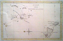 |
Cook, 1778
This map (with east at the top) shows the the southern island groups in Tonga, the Ha'apai Group on the left (north) and the Tongatapu Group on the right (south). The large island is Tongatapu, where the majority of the population resides. The smaller island nearby is 'Eua. |
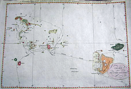 |
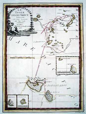
Hogg, 1785
A similar map to the one above, this map shows Cook's route between the various islands. |
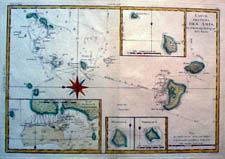 |
Bonne, 1787
Also based on the Cook map above, this map includes a number of insets, with details of (clockwise from top) Wateeoo Ette and Wateeoo Islands, Niniva (??) Island, Mangeea (today, Mango) Island, and the Harbor of Tongataroo.
|
 |
Cassini, 1798
Nice chart of the Ha'apai Group (above) and Tongatapu Group (below). |
|