|
New Zealand
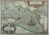
Two large islands east of Australia, New Zealand was not well known to western explorers until late in the 18th century. Earlier maps show only small parts of the coastline. See the 1691 Coronelli and 1753 Bellin maps of the Pacific for examples.
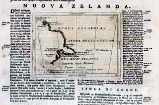 |
Coronelli, 1696
First printed map to show any part of New Zealand, based on discoveries by Tasman in 1642
|
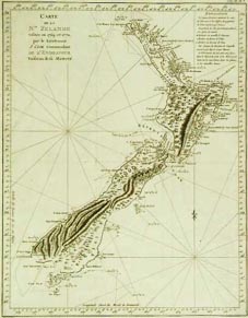 |
Cook, 1774
Based on information collected during Cook's first voyage, this was one of the very first western maps to show all of New Zealand. |
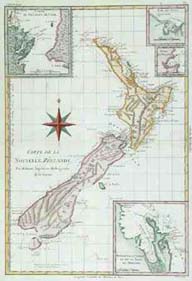 |
Bonne, 1778
Detailed map of New Zealand, including several insets of major bays and the straits between the two main islands. The basic map is based heavily on Cook's map. |
|