|
Marianas Islands (including Guam)
Discovered by Europeans in the late 1500s, the Marianas Islands can be found in early antique maps of the Pacific, and were also often included alone in world atlases. The islands were also known as the Archipelago of St. Lazare and the Isles of Larrons.
|
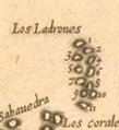
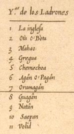
Herrera, 1601
Detail from a map of the East Indies, showing the islands and including a key to the names of the various islands. |
 |
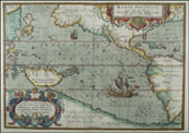
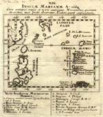
Sanson, 1652
The right hand side of a double map of the Philippines and Marianas Islands. |
 |
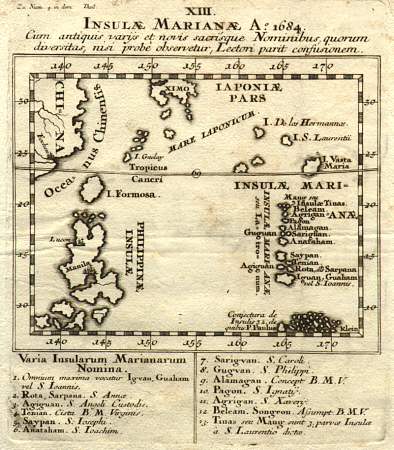
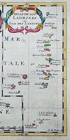
Stocklein, 1684
Map of the Marianas Islands as well as parts of the Philippines, China, Palau, and Japan. The legend at the bottom of the map lists the names of the various islands.
(Click on the map to see a larger version.)
|
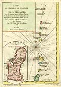 |
Bellin, 1752
A nice sea chart of the Marianas Islands with a detailed map of Guam. |
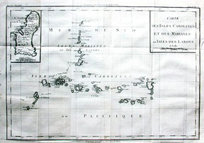 |
De La Tour, 1797
Chart of the Carolines (lower set of islands, horizontal orientation) and Marianas (upper set, vertical orientation.
|
|