|
Japan
The westernmost island in Indonesia, Sumatra is located adjacent to the Malaysian peninsula. As a result of its location and importance, it appears in many of the earliest maps of this region.
 |
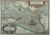
Fries, 1522
Earliest map showing China and Japan (circled in white). There are two place names in Japan, and the ocean between China and Japan is labeled as the "Indian Ocean". |
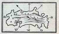 |
Bordone, 1528
Map of Japan based on second-hand reports of Marco Polo. |
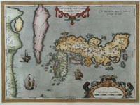 |
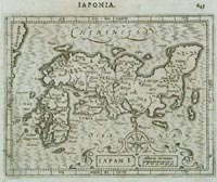
Ortelius, 1595
One of the earliest western maps of Japan, with the "island" of Korea shown (in pink) to the northwest. |
 |
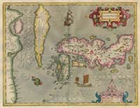
Hondius, 1606
From another classic mapmaker, a quick comparison makes it clear that Hondius is based on the earlier map of Ortelius, with more focus just on Japan. |
 |
Mercator-Hondius, 1630
Updated version of previous map. |
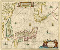 |
Jansson, 1650
Map showing Japan in larger context of northeast Asia. |
 |
Blaeu, 1665
Unlike the earlier maps, this map shows political subdivisions, and also presents more accurate representations of both Japan and Korea. |
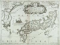 |
Coronelli, 1692
An attractive map, created about thirty years after the Blaeu map, shows very similar views of Japan. |
 |
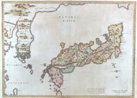
Tirion, 1740
A detailed map, about fifty years after the Coronelli map.
|
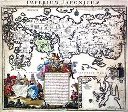 |
Seutter, 1740
A fascinating looking map of the same vintage as the Tirion map above. |
|