|
Indonesia - Sumatra
The westernmost island in Indonesia, Sumatra is located adjacent to the Malaysian peninsula. As a result of its location and importance, it appears in many of the earliest maps of this region.
 |
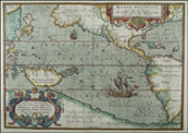
Gastaldi, 1556
A fairly good representation of Sumatra, especially compared to the Ptolemy map (following this), that was drawn at essentially the same time. |
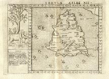 |
Ptolemy, 1562
An extremely early map of the island of Sumatra by the famous cartographer, Ptolemy. The shape of the island is very inaccurate, as are the place locations. |
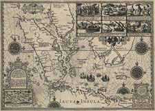 |
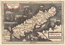
Lodewijcksz, 1598
An extremely detailed map of the island of Sumatra (center left), with portions of Java (bottom), and Borneo (peaking out from under the diagrams). The Dutch were the first westerners to colonize the area, and this represented their first mapping of these important islands. This link lets you see examine the map in great detail.
From the James Ford Bell Library, University of Minnesota. |
 |
Bertius, 1616
An early map of the island of Sumatra, with west at the top of the map. Java appears on the left edge of the map, and part of the mainland of Malaysia on the right. |
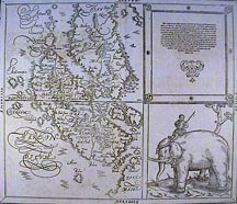 |
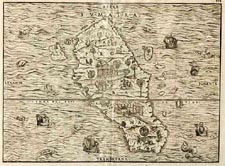
Munster, 1628
A fairly detailed map of Sumatra, accompanied by a drawing of a native on an elephant!
|
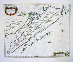 |
Jansson, 1650
Island of Sumatra and the Strait of Malacca (between Sumatra and Malaysia). Note that north is to the left on this map. |
 |
Valentijn, 1726
A very detailed map of Sumatra (right center) and the Malaysian peninsula (upper left). Note the orientation of this map is also to the east. |
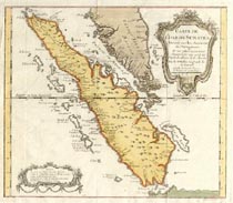 |
Bellin, 1750
A very nice map of the island of Sumatra. |
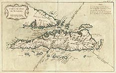 |
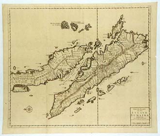
Bellin, 1750
Another map of Sumatra by Bellin, this has been oriented in a very unusual fashion in order to allow the island to be displayed in a horizontal manner. (Compare with the map above.) |
|