|
French Polynesia
French Polynesia consists of several island groups, including the Society Islands, Marquesas, Tuamotus, and Austral Islands. Tahiti, in the Society chain, is the most important island, with the capital of Papeete.
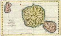 |
Bellin, 1769
Map of the islands of Tahiti and Moorea (upper left), based on maps drawn by Captain James Cook.
|
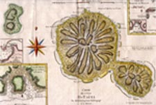 |
Bonne, 1790
The same basic map of Tahiti and Moorea as the Bellin map above, but with several insets containing details of several bays and islands:
- center left: Bay near Point Venus, northern part of Tahiti
lower left: bay on Moorea (referenced by its old name of Eimeo)
upper right: small set of islands titled something like "Marquises de Mendoce" (Marquesas?)
|
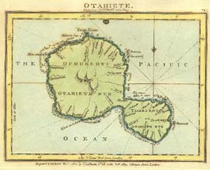 |
Luffman, 1799
Island of Tahiti, with some of the interior rivers named. |
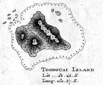 |
Cook, 1781
Chart of Toobouai (Tubuai) Island, located 350 miles south of Tahiti in the Austral Islands. This island was briefly the home of the Bounty mutineers. (This is from a map made of this map and maps of two islands in the Cook Island chain.) |
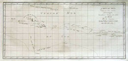 |
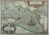
Benard, 1784
Hard to read map (sorry!) showing the Society Islands. Includes are Tahiti, Bora Bora, Huaheine and surrounding islands. Also shows the routes of Commodore the Hon. John Byron and Capt. Mouat in 1765, Captains Wallis and Carteret in 1767, and Capt. James Cook in 1769. |
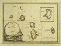 |
Cassini, 1798
Society Islands, including Bora Bora, Huahine, and others. The inset is of Christmas Island, not anywhere near the others! |
|