|
Cook Islands
A small group of islands (most of which are atolls) located between American Samoa and French Polynesia in the south Pacific. The islands are clustered in two small groups. Rarotonga, in the southern group, is the most populated island.
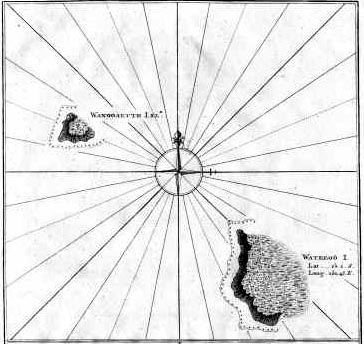 |
Cook, 1781
Map of Wanooaette (sp?) (Takutea) and Wateeoo (Atiu) islands, part of the southern group of islands. From a map that contained this map, the one of Mangai below, and a map of Toobouai Island from French Polynesia
|
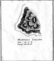 |
Cook, 1781
Map of Mangaia Island, the southernmost island in the Cook Island chain
|
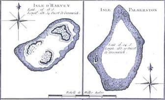 |
Benard, 1795
Charts of two of the atolls in the southern group of the Cook Islands:
* Isle d'Harvey (today called Manuae); this was the first island in the chain to be discovered by Captain Cook
* Isle Palmerston (Palmerston Atoll)
(From a chart containing four maps of individual South Pacific islands.)
|
|